DOLCÈ, LAND OF FORTS, NORTHERN BORDER OF VALPOLICELLA
nature trails

This itinerary aims to make the area's resources known and valued. In it you will find a useful guide to the new cycle path from Volargne to Borghetto d'Avio, designed for lovers. of all ages, of nature and of slow outdoor activities.
In it you will find a useful guide to the new cycle path from Volargne to Borghetto d'Avio, designed for velocipide enthusiasts, and some loops and paths for trekking lovers. Here, surrounded by fantastic scenery, you can practice other outdoor sports: rafting and canoeing on the Adige River, climbing on the rock gyms.
ROUTE 1: CiclAdige Terra dei Forti
Easy and varied cycle route, alternating stretches along the left bank of the Adige river
to others among vineyards and orchards or close to the foothills among mixed woods of
hornbeam and downy oak; for each village there is a diversion that allows access
to the inhabited centre.
VILLA DEL BENE
Villa del Bene, at Volargne, built in the 15th century, is connected by a row of cypress trees to the Adige River.
The palace, with surrounding buildings and land, was owned in the first half of the 16th century by Antonio Malfatti, who sold it to Giovanni del Bene in 1538-9. Upon entering, one can admire: the monumental entrance portal by Michele Sammicheli, the courtyard, the frescoed rooms on the first floor, being fascinated
by the building.
THE CERAINO LOCK
This section, where the Adige River crosses a narrow gorge between Monte Pastello and the Rivoli hills, offers one of the most evocative views of the valley. Its particular conformation originated due to the transverse position assumed by the mountain with respect to the direction of the valley, with tectonic movements dating back several million years.
Over time, the Chiusa has had considerable strategic and military importance, representing a sort of obligatory passage for kings, emperors and armies in arms, to and from the Brenner Pass.
A number of rocks in the Dolce area, frequented by climbing enthusiasts, offer the incomparable spectacle of a view of the river. Climbing them is exciting and exhilarating; the rock has remained rough and clean even on the most affordable routes.
ROUTE 2: Villa del Bene - Ceraino (Passing through the lock)
Starting from Villa del Bene, descend along an ancient cobbled road that leads to the Adige river, prose-
northwards we enter the ‘Canyon’ of the Chiusa, until we reach the village of Ceraino,
where you can admire the moraine hills carved out by glaciation.
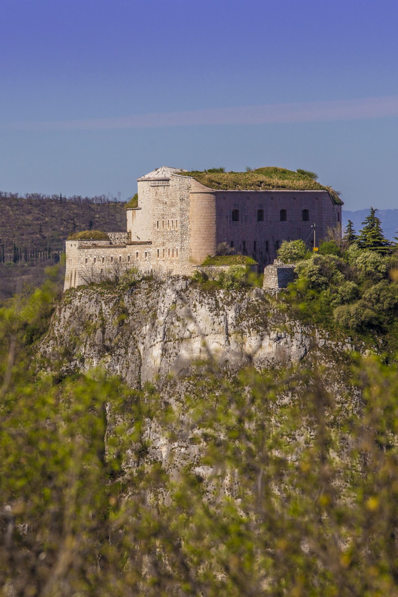
FORT OF CERAINO
Fort Hlawaty, is one of the best known Austrian fortifications on the left side of the Adige. From 1866, after the annexation of the
sion of Veneto to the Kingdom of Italy, it assumed the name of Fort Ceraino. Built between 1850 and 1851,
it was named after Lieutenant Field Marshal Johann von Hlawaty. The construction was desired, along with
with others, by Field Marshal Radetzky to create a barrier towards the Brenner road
and the Vallagarina outlet. It can be reached by following a path that leads to the square outside, from which the
which offers a splendid panorama of the Valdadige towards the south.
ROUTE 3: Ceraino - Fort Hlawaty
A long itinerary that climbs from the centre of Ceraino along the old military road to the ruins of the Austrian forts of Ceraino.
RIPARO SOMAN
This is an under rock shelter at the foot of the slope on the orographic left of the Adige river, between the villages of Ceraino and Dolce. A Bronze Age burial site of probable females was found here by chance in 1983. The study of the different archaeological levels and of the lithic industries brought to light, made it possible to date the presence of man between the end of the Upper Palaeolithic and the Early Neolithic, i.e. between 11,000 and 5,000 years B.C.
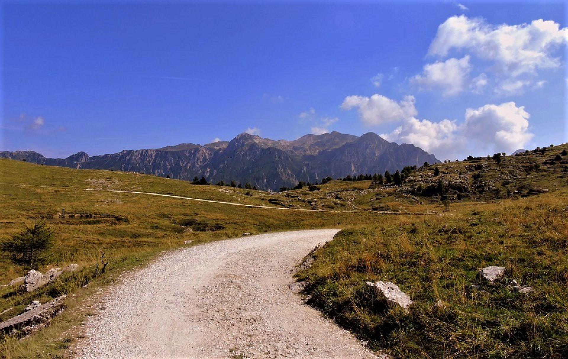
ROUTE 4: Dolcè - Monte Pastello
From the main square of the town, climb up along Via Castello to take the Cai (Italian Alpine Club) path no. 236 to one of the many bends of an abandoned cart track that continues almost to the summit of the mountain and then follows the route of a mule track towards Molane. At the crossroads before the contrada, turn right
and then climb abruptly towards the peaks of Monte Pastello. From the summit, despite the unsightly antennas, the panoramic views towards Lake Garda, Monte Baldo and the Po Valley are truly unique.
THE WOOD OF POETS
Situated between the main town Dolcè and the hamlet of Peri, the Bosco dei Poeti is a vast natural area with 130 hectares of woodland and 12 kilometres of convenient paths. A thousand works by about six hundred Italian and international artists are exhibited here, along with a precious series of poems and drawings. A magical place for the mind, where the body is also well, thoughts flow and the skin breathes.
ROUTE 5 Peri - Breonio
The itinerary starts from the church of Peri along the Cai path no. 252, which quickly gains height
allowing the hiker to enjoy splendid views in sometimes steep and exposed stretches.
exposed sections. Pass the suggestive rapids of the Rio Casarole and climb up to the meadows above Breonio.
SPURGA DELLE CADENE
Grotta di Peri, reserved for experienced cavers, is known as Spurga Ile Cadene. This ravine offers truly impressive spaces and formations: the Hanging Lake, the White Hall and the new Hall of Wonders.
CANOEING AND RAFTING
The stretch of the Adige River that runs through the Dolcè area, which is particularly uncontaminated, evocative and rich in flora and fauna, is ideal for descending the river in canoes and rubber dinghies. Here, every third Sunday in October, the Adigemarathon takes place, an international canoe and kayak marathon that brings together hundreds of competitors from all over the world. From the picturesque Island of Dolcè, the non-competitive paddling of enthusiasts begins. Thousands, in canoes and on rafting dinghies, follow the course of the current to the finish line in Pescantina. For the descents, the moorings are as follows: Peri, south of the bridge, between Peri and Rivalta; at the island of Dolcè; at Ceraino, via Battello, beach; at Volargne, descent in front of Villa del Bene.
ROUTE 6: Ossenigo - Montarione
The route starts out near the little church of Sant'Andrea, just above Ossenigo, along the Cai 250A path, which climbs along a forest road until it leaves the forest near Malga Montarione, where an always open room offers hikers shelter. Continuing along a variant of the Cai path, right on the border between Veneto and Trentino Alto Adige you will come across some ancient boundary stones and the remains of trenches from the First World War.
MALGA MONTARIONE
The municipal territory of Dolcè, in the Adige Valley, has among its riches the presence of a historical locality
called ‘Malga Montarione’, inside the Regional Natural Park of Lessinia. The areas are
property of the regional state and are managed by Veneto Agricoltura.
For the descents, the moorings are as follows: Peri, south of the bridge, between Peri and Rivalta; at the island of Dolcè; at
Ceraino, via Battello, beach; at Volargne, descent in front of Villa del Bene.